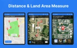
Explore the functionality of Distance & Land Area Measure—an indispensable tool for acquiring precise geospatial information. It's perfect for a variety of needs such as planning construction projects, assessing real estate, or managing agricultural tasks. The app provides accurate GPS-based measurements directly to your device.
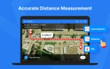
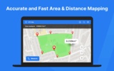
With the ability to calculate areas by simply marking them on the intuitive map interface, users can measure any location without having to be there physically. This multifunctional tool enables the measurement of distances between multiple points all over the world, offering versatility for a broad spectrum of uses.
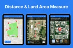
The process is straightforward: users tap the map to set markers and receive instant calculations. It supports both GPS and manual measurements, ensuring accuracy combined with simplicity. If a mistake occurs, points can be easily deleted or adjusted. The zoom function enhances the precision by focusing on specific areas.
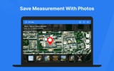
Users can effortlessly save their data post-measurement. Each record can include names, descriptions, and images taken from the device's camera or gallery for an in-depth log. The Point of Interest (POI) feature allows for pinpointing and saving exact coordinates for future reference.
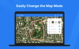
Considering the visual aspect, one can toggle the map's view between normal, satellite, terrain, or hybrid modes according to personal preferences or project requirements. Users may edit pre-existing measurements and handle data in KML and KMZ formats, facilitating comprehensive record management.
Conveniently, all saved measurements are accessible in the software's Saved folder, ensuring easy retrieval. Owing to its neat interface and robust capabilities, Distance & Land Area Measure offers a reliable and straightforward GPS-based measuring solution.
Requirements (Latest version)
- Android 4.4 or higher required










Comments
There are no opinions about Distance & Land Area Measure yet. Be the first! Comment